How Ingenuity Helicopter performs state estimation and localization

Ingenuity Helicopter

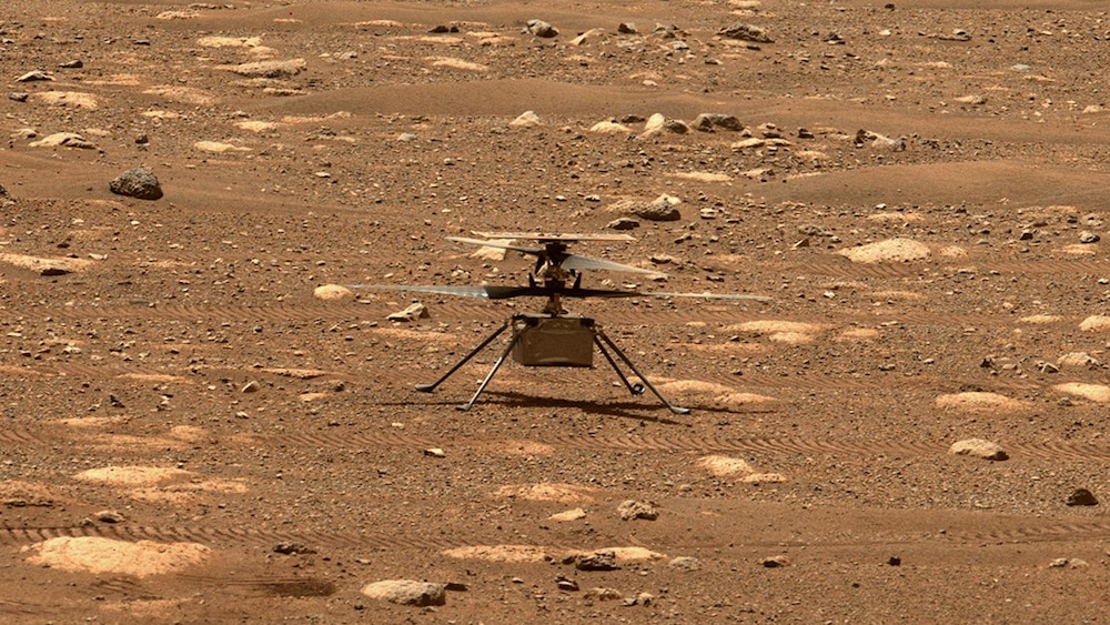
NASA’s Ingenuity Helicopter unlocked its rotor blades on Mars. | Credit: NASA/JPL-Caltech/ASU

I’ve been captivated by the NASA Ingenuity Helicopter in the past month. I was curious to know more about the helicopter’s localization and state estimation technology – what sensors and software does the helicopter use to figure out its position and orientation?

Luckily, NASA is eager to share the technical details of its accomplishments, unlike the typical commercial robotics venture trying to outpace its competitors. So I read several blog posts and academic papers that NASA researchers have published to describe the helicopter and its software. Here’s what I found.

The post How Ingenuity Helicopter performs state estimation and localization appeared first on The Robot Report.

More Related Posts

How Artificial Intelligence, Machine Learning, and Simulation Work Together

As artificial intelligence (AI), machine learning (ML), and simulation revolutionize the way...

Industrial robot shipments exceed 500,000 units in 2023

Overall global industrial robot shipment volumes exceeded 500,000 units in 2023, Interact...

WEKA Sheds Light on Data Infrastructure Challenges Hampering AI Adoption at Scale

According to a new global study conducted by S&P Global Market Intelligence...

Home

Highly Niched Headhunters Specialized in Physical AI/Robotics, High-Performance Computing, Unmanned/Autonomous Systems, Defense Technology and Energy.

Specializations

We recruit across complex engineering markets where understanding the technology is critical to finding the right talent.

How We Work

Overview of how PACE partners with teams: Our process, what clients get, and why PACE is different.

About Us

PACE’s story, values, and culture define how we operate and who we are.

News & Insights

Stay up to date on industry trends.

Contact

All the information needed for anyone interested in contacting us.